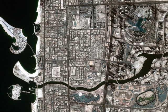
DUBAI // A stunning photograph of the newly completed Dubai Canal has been taken from space by DubaiSat-2, a satellite operated by Mohammed bin Rashid Space Centre.
The image shows the waterway connecting the Dubai Creek to the Arabian Gulf through neighbouring Safa Park.
The development has so far included construction of a bridge for traffic on Sheikh Zayed Road, plus bridges on Al Wasl and Jumeirah Beach roads, all of which can be seen in the image.
Once complete, the canal development, which is three kilometres long, will feature hotels, shops and restaurants, and public walkways.
Earlier this week, the Roads and Transport Authority announced the opening of nine marine stations, four at Business Bay and five along the canal, for water taxis and ferries.
Launched in 2013, DubaiSat-2 captures high-resolution images as it circumnavigates Earth 14 times a day, including four times over the UAE. The second UAE-owned satellite was built mainly by engineers in Dubai and South Korea. More info
By National Staff www.thenational.ae


