Source: www.economictimes.indiatimes.com
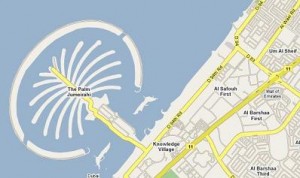
DUBAI: Dubai’s Roads and Transport Authority (RTA) has teamed up with Google to provide an interactive street map, which could make getting around the city easier for residents and visitors.
 The introduction of route mapping makes Dubai the first city in the Middle East and North Africa region to be featured on Google’s online mapping website, which aims to provide motorists and pedestrians with accurate directions.
It includes bus routes and hotels, RTA’s website said. “Now you can plan your journey to anywhere in Dubai from your computer or your [smart] phone,” Abdullah al Bastaki, the information technology director of the RTA, said.
Google Maps is designed to give directions when an address or location is entered or when it is pinpointed on the map. After the user enters the intended destination a choice of directions for driving or walking is given.
The site map also shows available bus routes and estimates the time it takes to reach a destination. Users can also choose a district and browse area restaurants and attractions, or search for specific restaurants by name or type of cuisine.
Earlier this year, the RTA launched its own journey planner, called ‘Wojhati’, but it was not well-received by the public. Officials insist the early problems have been ironed out.
“At that time we didn’t have the right mapping to fit the roads but now we have the real roads mapped out and everything should be working fine,” al Bastaki said.


